The Istanbul Theodosian Walls
March-28-2012
Protection For An Empire
Published on 1-April-2012 by Ray Fried
National Defense
Istanbul is located in a strategic location and has been the focus of other empires that sought to dominate her. Two rather unique defense systems have been used. A 4 mile city wall, first envisioned by Constantine I, and also a huge metal chain drawn across an important water way on one side of the ancient city.
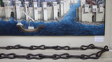
The chain was first installed in 1453
The Walls
The walls saved the city many a time during its wars against the Avars, the Tartars, the Russians, and the Bulgarians.
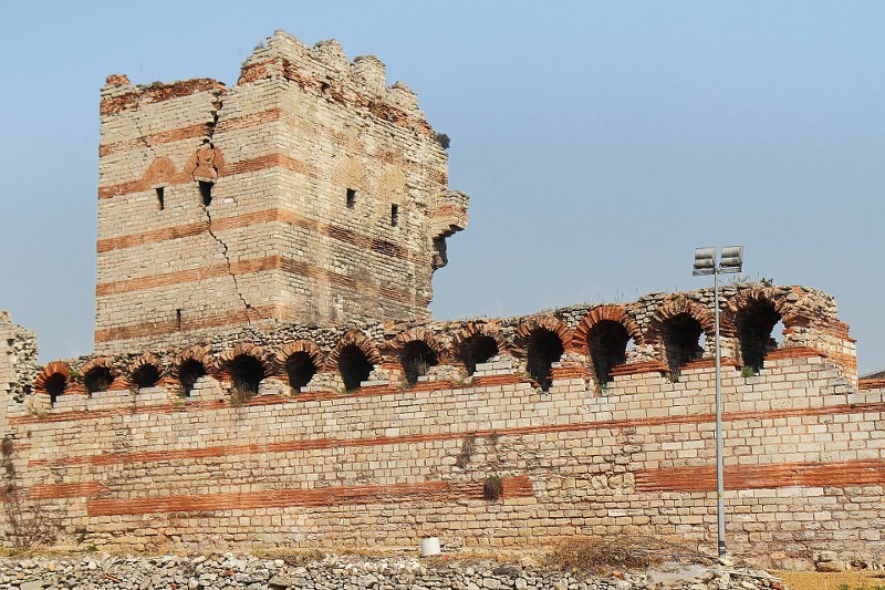
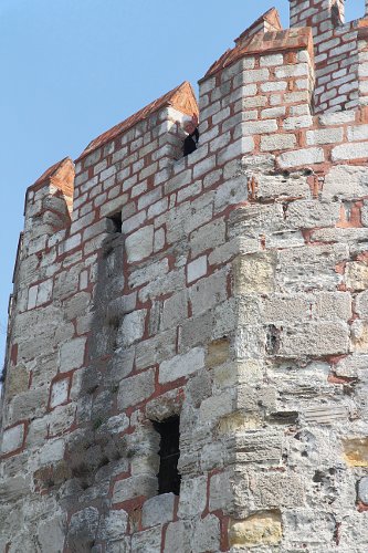
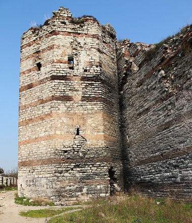
The walls were located on the outskirts of Istanbul, built by the Byzantine Emperor Theodosius II (408-450) who expanded the area of his imperial capital of Constantinople by building these great land walls farther out into the country. They were breached only twice: in 1204 by the armies of the Fourth Crusade, and in 1453, a thousand years after they were built! by the gigantic cannon of Sultan Mehmet the Conqueror, after which Constantinople became Istanbul.
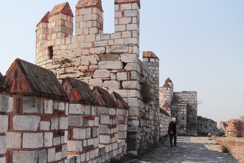
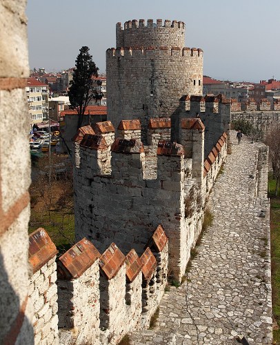
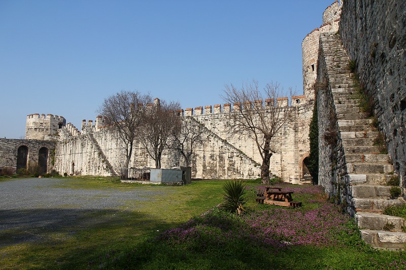
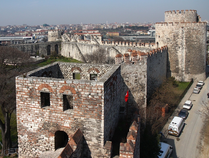
The walls encompass the old city in a great arc, stretching from the Golden Horn (Haliç) to the Sea of Marmara. A triumph of engineering, the walls comprise inner and outer ramparts with a terrace in between.
Wall Of Gates
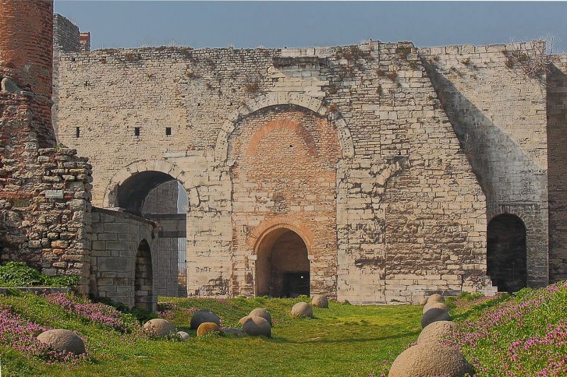
 The wall includes
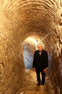
8 gates that are still used to allow foot and car traffic in and out. Some of the
gate complexes included towers, passage ways and dungeons where many diplomats
(and some Ottoman sultans) were imprisoned and executed during the time of
the Ottoman empire.
The wall includes
8 gates that are still used to allow foot and car traffic in and out. Some of the
gate complexes included towers, passage ways and dungeons where many diplomats
(and some Ottoman sultans) were imprisoned and executed during the time of
the Ottoman empire.
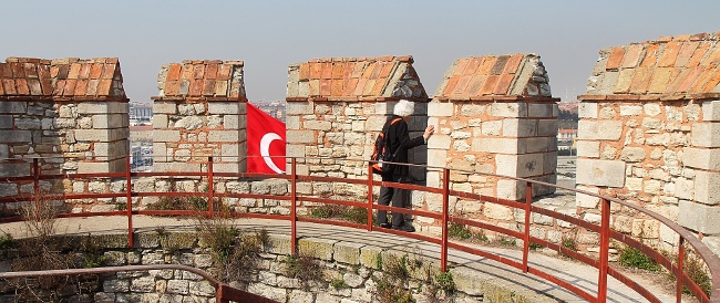
We enjoyed a nice day as we walked the full length of the walls. In places we could walk on the wall and at certain gates and towers, we were able to climb up for a good view. As you view photos in the viewer below, keep in mind that some of the photos are taken up on the city wall at an elevation of perhaps 25 feet.
The photo below shows both the wall and the location of the metal chain that spans the Haliç (Golden Horn estuary).
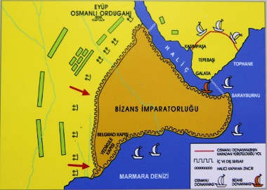
Photo Viewer
Below are some photos taken at the Theodosian Walls and gates. To view them, just click on any thumbnail below as a starting point. Then you can either press "N" for the next photo or "P" for the previous picture. If you place your mouse near the upper left or right of each expanded picture, you can also navigate by clicking on Prev or Next. When finished, click on "CloseX".